
Cutler Bay Neighbor Record Sources
No official source publishes a complete list of every person on a Cutler Bay block. The useful public sources instead describe land, owners, selected municipal events, and nonprotected voters. Begin with the parcel map because it defines the immediate area. Then open each parcel in the Property Appraiser roll and compare its situs address with the tax mailing address. Permits, code files, and recorded documents answer narrower questions.
| Source | What It Shows About a Block | Access |
|---|---|---|
| Cutler Bay Town GIS | Adjacent shapes, owners, folios, ZIP, subdivision, HOA and district layers | Free map; HOA boundaries are incomplete |
| Miami-Dade Property Appraiser | Owner, situs, tax mailing address and parcel facts | Free current assessment roll |
| State voter extract | Nonprotected registered voters at addresses on the extract date | Public request and disk process |
| Town permits and code | Work or enforcement connected to selected addresses | Permits from 2010 online; code by request |
| Official Records | Ownership and encumbrance history for a legal description | Free standard index; paid copies |
| Community associations | Published organization contacts and mapped areas | No verified public member roster |
The assessment roll supports ownership, not a full occupant list. A matching situs and mailing address may suggest owner occupancy. Homestead status adds support, but still does not identify relatives, renters, or other household members. A different mailing address may reflect a trust or administrative choice rather than an empty home. Cross-check facts before deciding who your neighbors are.
Select Cutler Bay's Nearby Parcels
The Cutler Bay WebGIS is built for the block task. Search the target by Address or Folio, open its parcel information, and leave the parcel layer on. Click each surrounding polygon. The “Add to existing selection” control can hold several lots in the Results list. Its layer stack includes subdivisions, plats, ZIPs, flood areas, districts, and a draft HOA layer.
Map layers provide context, not certified proof. The Town says HOA boundaries are incomplete and not exact. Parcel geometry can also lag a recorded split or combination. Compare every selected folio with the Miami-Dade Property Search, which shows the current assessment roll and mailing fields.
Note: Keep a short block list of folio, situs, owner, and mailing city so similar names do not become mixed across parcels.
Map Cutler Bay Neighbors Outward
A block search needs a clear boundary. For the nearest Cutler Bay neighbors, use contiguous parcel polygons. For a wider area, the County Community Services viewer documents a change-search-radius control. Do not treat a ZIP, subdivision, or HOA overlay as the same thing as a city boundary. Each answers a different geography question.
- Locate the known address or folio in Town WebGIS and open its parcel details.
- Select the parcels that touch it, then add the lots across the road if they belong in the intended block.
- Record each folio and check it in the Property Appraiser roll for owner, situs, mailing address, and homestead context.
- Add permit or code events only when they answer a specific question about the selected address.
- Expand by radius only after saving the immediate parcel set, so the result does not drift into a whole neighborhood.
This method stays focused on the small area around one home. For every parcel along an entire named road, use the Cutler Bay street directory workflow instead.
How Many Cutler Bay Parcels
The preliminary 2025 Cutler Bay roll contains 15,153 real-estate parcels, including 10,777 single-family parcels and 3,628 condominium units. It also includes multifamily, commercial, and vacant parcels. That scale explains why a map selection is more useful than a broad owner-name result for finding a block.
Condominiums require care. One building can contain many folios stacked at the same situs, while a common parcel may serve shared land. A block map is therefore a parcel-derived picture, not a count of households or Cutler Bay neighbors. Use land-use and parent-folio context to keep condo units and common areas distinct.
Cutler Bay Community Contacts
The Town's draft HOA layer names several master groups and sub-associations. It can point a resident toward the organization connected with a development, but it does not prove membership and supplies no public resident directory. Use only contacts that an organization or public body chooses to publish.
Isles at Bayshore
Master association area with mapped Catalina, Reserve, Palms, Cove, Enclave, Courts, and Trellis sub-associations.
Old Cutler Lakes
A named master association in the Town's incomplete HOA geography layer.
Saga Bay
A master association name tied to a community replatted in 1972.
Shores Community
Master group with Shores condominium areas 1 through 3 shown in the draft layer.
Tides is marked “not registered” in the layer. Congregations, watch groups, clubs, and associations may keep voluntary private lists, but those are not public records. The Cutler Ridge Woman's Club publishes joining and meeting contacts, not a member roster.
Florida Voter Data by Block
The public self-lookup is designed for a voter checking their own registration. It requires exact first name, last name, birth date, and a lawful-use acknowledgment. It is not a block browser. A block-level project instead uses the Florida statewide voter extract request or a focused public-record request, subject to exemptions.
Public voter information can include name, address, date of birth, party, phone, and email. Social Security numbers, driver-license or state-ID numbers, the registration source, and copying of the signature remain protected under Florida law. Protected voters and unregistered residents will not form part of a public block list.
The state voter extract page shows the proper request route for public data.
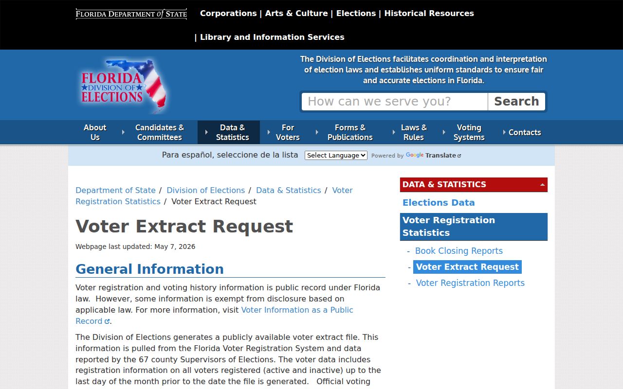
This request channel is the documented alternative to trying to reuse the personal self-lookup as a neighborhood search tool.
Add Cutler Bay Address Events
Town permit records can attach an applicant, owner, project, date, status, subdivision, or parcel to an address. The online system covers records from August 1, 2010. For earlier permits, call the Building Department at 305-234-4193. Code Compliance handles complaints, warnings, citations, Special Master matters, and liens through phone, in-person, and online request routes.
These files describe an event at land. They do not name all Cutler Bay neighbors. A contractor, former owner, or applicant may appear without living there. If the online portal does not return the needed record, the Town Clerk accepts requests by web form, phone, email, fax, or in person. Give the address, folio, record type, department, and date span to reduce search time.
Cutler Bay has three code-enforcement zones and receives more than 700 complaints in a year. A complaint is not the same as a final violation, and a warning is not a Special Master order. Ask for the record status and underlying document before tying an event to a person. Town lien verification covers code violations, false alarms, and unsafe structures, but it excludes permit status.
Official Cutler Bay Rolls Compared
Official records and commercial neighbor tools may show similar names, but their evidence and update paths differ. A county parcel record identifies its custodian, assessment purpose, folio, and update warning. A commercial compilation may combine old deeds, phone listings, or other feeds without explaining when a person moved.
| Source type | Best use | Main limit |
|---|---|---|
| Official parcel and GIS | Defining lots and confirming the assessed owner | Does not list all occupants |
| Official voter data | Confirming a nonprotected registration at an extract date | Omits protected and unregistered people |
| Commercial compilation | Possible lead for further checking | May lag deeds, moves, and corrections |
Prefer the official roll for a claim it was created to support. Correct an error with the custodian. Commercial suppression is separate and does not erase a lawful county deed or tax record.
Read Cutler Bay Block Names
Modern parcel labels sit on older community geography. Cutler Ridge developed from 1954, Whispering Pines and Bel Aire from 1957, Saga Bay was replatted in 1972, and Lakes by the Bay began in 1983. Older records may use Cutler Ridge, Perrine, or Dade County because the Town incorporated in 2005. A block near Franjo Road may also appear under its numbered name, SW 97 Avenue.
Use those aliases when a map and written record seem not to match. Folio and legal description anchor land more firmly than a community label. ZIP codes also fail as jurisdiction proof: 33157 crosses the municipal line, while 33189 covers much of central, southern, and eastern Cutler Bay. Confirm the town boundary with an official layer before treating a nearby parcel as part of Cutler Bay.
Protect Cutler Bay Neighbors' Privacy
Utilities, deliveries, and customer accounts are not public resident directories. Florida's Address Confidentiality Program supplies eligible participants with a substitute address and mail forwarding. Separate exemptions can shield the addresses of certain high-risk professionals. A missing person in public records may be protected, unregistered, a renter, a relative, or simply absent from the source being searched.
Florida's voter confidentiality law protects key identifiers, and its Digital Bill of Rights gives qualifying consumers rights against covered large data controllers. Those rules do not create a general right to erase a lawful deed. Keep neighborhood research narrow, verify public facts with the custodian, and do not publish a compiled roster of living people.
Florida's official confidentiality statute explains what voter information remains protected.
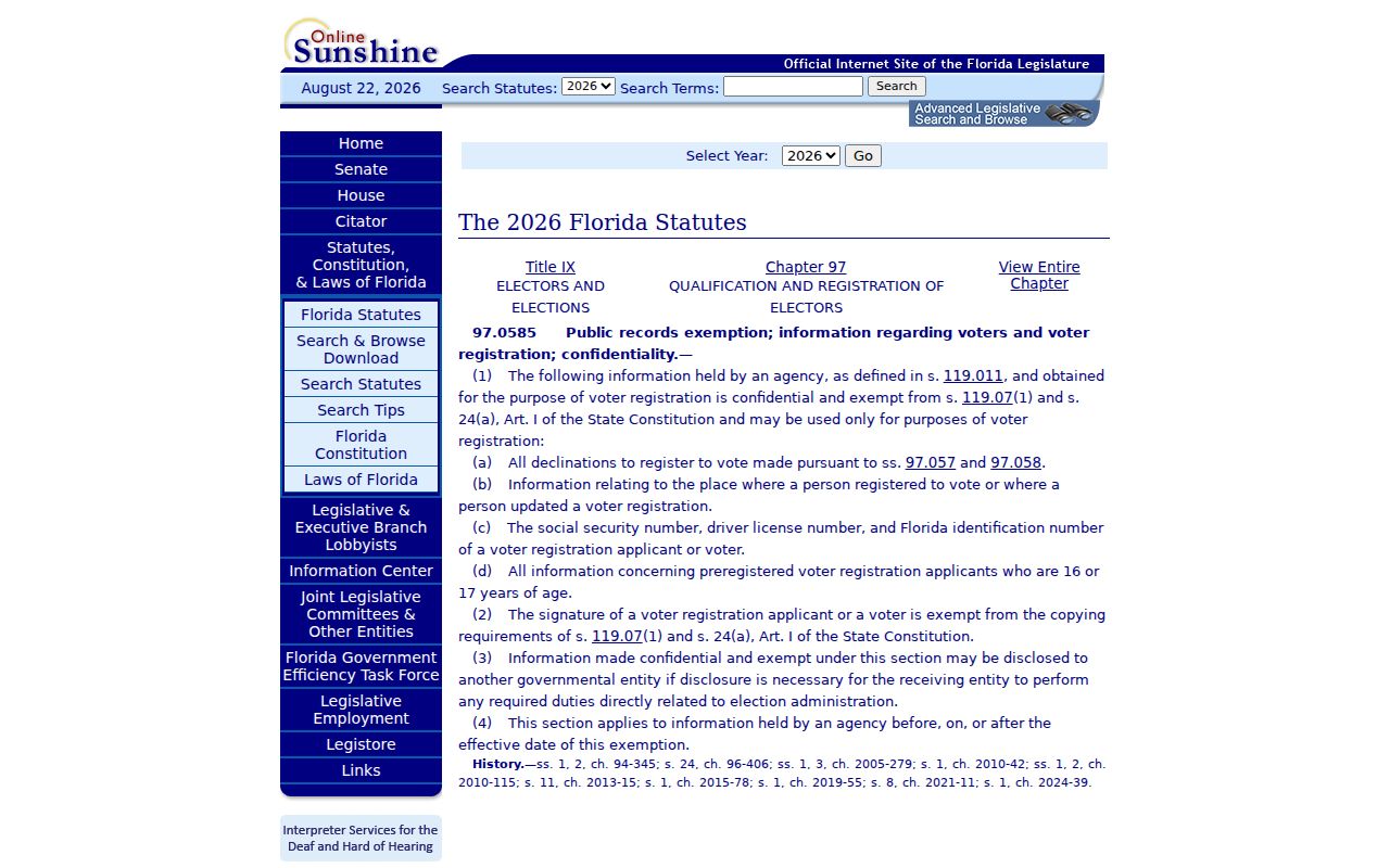
The statute sets firm limits on identifiers and signature copying even when other voter fields are public.
Lawful use. Look up Cutler Bay neighbors for civic curiosity, reconnecting, or personal safety awareness. Never use public records to watch, harass, intimidate, or harm anyone.